Friday, May 11, 2012

One out of two - Alpine style in the Himalaya - Cholatse and Kyajo Ri


In March 2012, I headed to Nepal to climb Kyajo Ri (6186m, otherwise known Kyazo Ri) and Cholatse (6440m). I have tried to write this trip report in a way as to provide information for future parties who wish to attempt these mountains. Enjoy. Be inspired.

Life was busy and 2012 was bound to be a busy one but I needed to get back to the mountains. I looked at my calendar and figured I could wrangle a month off around mid-March. Next came the big questions of an objective and teammates for the climb.

I decided on Nepal as a destination because of the easy logistics and reasonable airfares, and decided on two 6000m peaks as objectives for the trip. Kyajo Ri (6186m) would be solid ‘warm up’ peak to acclimatise on and Cholatse (6440) would be the second objective. Now all I needed was a solid partner who had the time and was keen for some suffering. On Christmas day, Tim, one of my British mates from Sheffield, sent me an email letting me know he was in. Maybe the five red wines he had drunk that day helped convince him that it was a good idea to leave work and home duties for the simplicity of the Himalayan mountains. It was on. We had an objective, a solid team and a plan.
In mid March, I arrived in Kathmandu. It was still a quiet part of the year with not too many tourists around. My trusty agent Nima had helped me arrange flights into the mountains and some strong porters to help us with our equipment. I am quite used to the hustle and bustle of the traffic in Kathmandu but Tim never stopped being transfixed by the near misses and seemingly hectic traffic that resembled some kind of ordered chaos.

TimAfter flying into Lukla (2700m), we began the 5-hour trek to Monjo (2700m), the trails still relatively quiet in the middle of March with a hint of winter still in the air. After a few hours of walking the following day we made our way to Namche Bazaar (3400m), the bustling Sherpa village in the heart of the Khumbu. After an active rest day trekking up to Khumjung, we made our way to Thame (3800m) as part of our acclimatisation schedule. A few hours into our trek to Thame, the soles on Tim’s boots started flapping and peeling off his boots. After some taping repairs, we eventually made it to Thame but the boots were looking decidedly average. We both felt quite strong so we decided to head up to Mende (3700m) and Kyajo Ri Base camp (4500m) the following day.
TIm's mangled boots

The village of Thame (3800m)

Information on Kyajo Ri was a bit thin and hard to source because not too many expeditions venture into this harder to get to and more recently opened peak. After about two hours walking from Thame, we made it to Mende (3700m) and asked for directions to the Kyajo Ri base camp. Previously obtained information indicated it was only about 2 hours to base camp from Mende, but information from the Mende locals indicated that it was closer to 5- 6 hours so our porters didn’t want to continue that day because they needed to allow time to return to Mende or Namche. Tim and I were still keen to get to base camp that day so we loaded our packs with the tent and enough food and equipment for the next few days and headed up the steep yak trails past the monastery until some rock cairns led rightwards over a ridge. We continued to follow faint trails as the usual afternoon mist and cloud enveloped us. After around 5 hours, we made it into the Kyajo Dranka; an incredibly beautiful valley flanked by massive peaks, rock walls and frozen waterfalls. Spring had not arrived in the valley yet and most of the valley floor was covered in snow and ice.


On the way to Kyajo Ri BC


Kyajo Ri Base camp


2nd valley on Kyajo Ri

Dan and Prakash
Two of our porters, Prakash and Dan arrived around 9am the next morning after getting an early start from Mende. As they left for Namche, we told them to expect us in Namche in about 5 days time. Keen to get started, Tim and I loaded our packs with climbing gear and food and headed up the valley for an acclimatisation carry. The massive rock wall at the head of the first valley was easily ascended via a steep gully on the right side. Once the first rock wall was surmounted, a second long valley and the mountain we intended to climb became visible.
Kyajo Dranka in late Winter
After another night in base camp, we packed and headed up the valley again. We were barely acclimatised so the going was tough with heavy packs. Tim was complaining of some GI disorder and struggling for energy so we made camp 1 at around 5000m in the second valley. It was a beautiful campsite with a little stream nearby for water. I was feeling strong so I carried some equipment and food to the next camp at 5300m. There was some evidence of previous expeditions but it was remarkably clean and pristine.
Looking back down the second valley
Looking up the second valley toward the 2nd headwall and Kyajo Ri (just left of centre)

The next day, we made our way to camp 2 (5300m) in a few hours. Tim was still affected by his GI complaint and altitude so a rest day was scheduled in. We tested the effects of altitude on our brain capacity with Sudoku puzzles during the downtime. Tim’s completion of a ‘very hard’ puzzle signalled that he was ready to head up the next day.


Getting to camp 3 on the col at 5700m entailed crossing a frozen stream and lake, then a relatively straightforward glacier before ascending a steep snow and scree filled gully. After a few hours, we made it to the wind blasted col and set up the tent. With excellent views of the route to the summit and surrounding mountains, we feasted on the last of our cheese, salami and noodles and prepared for the impending summit day. We fed our salami skin scraps to the birds that visited us. Tim was hoping that an illusive yeti might make an appearance and eat some scraps but he disappointed us by not gracing us with his presence.
view of Ama Dablam from high camp on Kyajo ri
View across the lake and glacier of Kyajo Ri
Tim
 
The following morning dawned cold; the wind sucking the warmth from the hands. The first section of the route required some rock climbing that would be agonising and dangerous with cold bare hands so we delayed departure from camp till 8am. Tim took the lead on the first few rock and ice pitches though perfect granite and bulletproof blue ice. It had been a dry winter and there was very little snow on the mountain.  By the end of the day, the calves would be burning from endless front pointing (standing on the front points of our crampons) on the hard ice.
Tim on the rock band on Kyajo ri

After 3 pitches, I took over the lead and we began simul-climbing up 50-70 degree ice toward the summit, placing ice screws as we climbed. Black clouds were forming over the nearby mountains as we climbed at a steady pace, breathing hard in the thin air. Around 2pm, I stepped onto the summit and set up a belay to bring Tim up. We had amazing views of the south face of Cholatse, our next objective. We were supposed to be back in Namche by this time so we were overdue. We had no mobile phone reception so we had no means by which to notify people that we were OK. The bad weather was closing in so after a few minutes on the summit, we began abseiling back to camp 3 using v-threads in the ice and snow stakes.
Tim approaching the summit
TIm on Kyajo Ri
TIm on Kyajo Ri
TIm on Kyajo Ri
Tim descending back to tent after summiting Kyajo Ri

We arrived back at camp tired but still intent on making it down to camp 2 where it was warmer and less windy. It snowed for most of the afternoon, making the descent seem that little more desperate. Crossing of the frozen lake late in the day was going to be interesting because we didn’t know how thick the ice was. It seemed thick enough early in the morning when we first crossed it but after a few days of thawing, I wasn’t too sure. Tim thought it would be ok so we roped up and I suggested he went first. We were both carrying heavy packs and the thought of falling through the ice into freezing water a long way from help was unimaginable. Thankfully, we made it back to camp 2 without incident and settled in for the night. After an 11-hour day, we had one packet of minute noodles and 2 slices of salami. We had so far stretched our 5 days of food to 6 days, but this was the end of it. 10 minutes later, we used the last of our gas making tea. We were too exhausted to care and both crashed into delirious sleep.
Tim attacking the salami after summit day.
After a slow start and the last of our food- an energy gel each, we packed and headed down toward base camp. From the ridge above base camp, we saw two people waiting below. Without wanting to get our hopes too high, we waited until we reached them to confirm that it was our fantastic porters, Prakash and Dan.  They had walked up from Namche that morning after the lodge owner told them to come and look for us. We were overdue and they were worried. After splitting up the loads, we headed down.

We had been told there was a short cut to Namche via Khunde so we tried to follow a trail and water pipe trench leading to a break in the ridge above Khunde. The trail became exposed and unnecessarily dangerous at one point and we were not willing to risk the lives and safety of our porters or ourselves so we headed down through a thick thorny forest toward Thamo instead.

Four hours later, we walked back into Namche for a well-earned rest and food. Though sickness, exertion and lack of food, we had both lost a few kilos. Our clothes were now hanging off our frames.
After two days rest and some good food, we headed into up into the Gokyo valley up to Dhole (4200m). Feeling well acclimatised and rested, we covered the distance in about four hours. Cholatse became visible as we trekked toward the small village of Machermo(4400m) the following day. The mountain looked rocky and relatively bare of snow compared to previous times I had seen the mountain during post monsoon seasons.

SW ridge on Cholatse
View of Cholatse from summit of Kyajo Ri
Initially, we had planned to climb the north face of Cholatse, but after Kyajo ri took longer than planned and the scarce snow conditions of the mountains, we decided instead to try the South West ridge. The following day, our porters helped us carry some of our equipment up to the base camp and then headed back to Machermo to wait for us. From the base camp, the route followed a little valley from the left side of base camp to a moraine ridge overlooking the Cholatse glacier. We headed up the right side of the glacier in deep snow conditions, sometimes struggling in waist deep powder snow, and made camp at around 5400m nestled between the seracs on the glacier.
headwall leading to col camp on Cholatse

We woke with the inside of the tent covered in rime ice from our condensing breath. Every time we moved or brushed the tent the ice crystals covered us and filled our sleeping bags. We headed up toward the headwall leading to the col camp 5600m, weaving around some crevasses on the glacier. After crossing the bergshrund (crevasse that separates the mountain from the glacier), I encountered deep unconsolidated snow and spent around 10 minutes trying to make progress before retreating momentarily. We tried a few options before Tim tried without his pack on and made it through to some slightly more solid snow and made an anchor. After another hour and some steep snow climbing, we made it to the col, which was in remarkably different condition to the last time I was there in 2006. The smooth even snow had given way to foot high sastrugi (fins of windblown ice) that were extremely awkward to negotiate. Maybe it was the pre monsoon conditions, the dry winter or the effects of global warming. We did manage to perch our little tent on the only even patch of ice we could find and settled in for the night.

Site of our camp 1 on Cholatse (5400m)

After another night of hoar frost inside the tent, we packed and headed up the mountain. The rockwall that was the key to the rest of the ridge was about 30m high and sprinkled with powder snow, making it nearly impossible to climb. In 2006, compact snow was banked up nearly to the top and provided easy access to rest of the route. After climbing about 10m up the rock and snow, the holds disappeared and the snow became unconsolidated powder. There was little to no protection available and a fall in this location was unthinkable, especially with a 20kg pack. On inspection, there was an old fixed rope running over the blank rock to an anchor on the ridge. I managed to ascend the rope using prussic loops (pieces of cord wrapped around the rope) and place some pieces of protection along the way. Nevertheless, it was quite scary and exhausting.
Col camp - note the incredible sastrugi

Tim in the eye of the storm
Me embracing the amazing weather

The weather was deteriorating rapidly by the time I reached the belay and was snowing heavily by the time Tim reached me. It was 930am by this stage and we were in the beginnings of a full-blown storm. Neither of us could argue that we weren’t tired from the last few weeks of exertion. It had been tough operating on minimal food and carrying heavy loads but we weren’t ready to give up. Both of us hated the thought of failure after so much effort but the weather had other ideas. The storm was getting worse and the slopes leading to the col were loading up fast. It was time to go down. Retreating from a climb is possibly one of the most depressing moments of mountaineering. All the effort and planning seemingly for nothing, but the disappointment fades and the good memories remain. The freedom, the struggle, the fight for upward movement, the motivation and the time spent with good mates are the real reason we venture into these places. Summits are a bonus and one out of two isn’t too bad.


We made our way back to the col and began our descent down the glacier in a complete whiteout, following my instincts and the odd barely visible footprints to find our way off the glacier.  After a long day with heavy packs, we arrived back at Machermo around 7pm, tired and disappointed, but happy to be finished. We didn’t have enough time left for another attempt so we decided to walk out and return to Kathmandu in the hope of an earlier flight home. On the walk out, we encountered the throng of trekkers and climbers making their way to Everest base camp to either climb or just visit the base camp. It seemed a great contrast to the experience that Tim and I had both shared. On both mountains, we climbed entirely alone without seeing anyone else. It is a huge privilege to have the mountains to oneself away from the maddening crowds. All it takes is the decision to step away from the norm and step up to a new challenge.
Skinny me
Tim and I both had responsibilities back home that we now needed to focus on again. With a shower and clean set of clothes, we felt like new men but we had both lost a lot of weight. I had lost about 7kg and Tim looked a bit like a famine victim. I struggled to see him if he turned side on so he began a beer diet on reaching Kathmandu to rectify the damage. My body decided to lose some more weigh with a bout of food poisoning before I jumped on the plane home- all part of the third world fun. I returned home tired and happy, excited about a new job and ready for some recovery time. The body was in a state of fatigue but recovers quickly with rest and a return to training. Life continues on with another rich experience added to the mix.

With another trip over, it’s time to plan the next one.…

Big thanks to
Mountain Designs for their ongoing support and excellent kit
Seth at Sea to Summit (I used one of the new S2S sleeping bags on the trip and was super impressed)

Way down in Africa - solo on Mt Kenya North Face

In July 2012, I travelled to Africa for a look around and hoping to climb some stuff along the way. I ended up climbing the north face of Mt Kenya twice and cruising up the Machame route on Mt Kenya which was  a bit of fun and quite easy. The diving in Zanzibar and the animals in the Masai Mara national park were also highlights. Below is an article I wrote for Vertical Life magazine on my solo ascent of the North Face of Mt Kenya. enjoy.

For photos follow this link.
link to photos.

FINDING THE BALANCE

 
I couldn’t sleep. Every possible scenario was running through my mind in a mixture of anticipation and excitement. In a few hours I would be climbing the 800m North Face of Mt Kenya alone, drawing on years of accumulated experience to not just succeed but to survive. These emotions were familiar companions before a big climb. Many previous summit days had followed sleepless nights; the only difference was this time I would be without a partner to share the climbing, the route- finding and the experience. It was my time, my experience. In a few hours I would be doing what I had been planning for months.

In July last year I travelled to East Africa with the goals of climbing Mt Kenya (5199m) and Mt Kilimanjaro (5900m) and in the process experiencing some of Africa. In terms of climbing, Mt Kenya held the most appeal. It’s a beautiful rocky mountain capped by the twin peaks of Nelion (5188m) and Batian (5199m). It has a rich climbing history with technical routes on both rock and ice. Friends from Adelaide had visited in 2008 and climbed the Standard North Face route on Batian in three days and raved about it and the mountain’s flora and fauna.

On the first day, we squeezed into a local bus for four hours in moderately crazy traffic to make the journey from Nairobi to Nanyuki, near the base of Mt Kenya and the start of the Sirimon Route. The following day, we picked up our porters and begin the two-day walk twards the North Face and Shipton’s Hut (4200m). Mt Kenya was visible for most of the walk in, soaring into the sky and looking rather intimidating. Setting out from the hut the next day, Kate and I acclimatised by trekking up Point Lenana (4985m), the peak most visitors to Mt Kenya climb.

It had been a year since I’d been in the mountains, climbing, exploring and pushing body and mind beyond their normal limits. This is what I come to the mountains for – that intensity so often missing from everyday life.

The alarm sounded at 4.30am. I scoffed some breakfast and five cups of tea, shouldered my pack and began the one-hour approach to the base of the route through the pre-dawn gloom. Light filled the sky as I began climbing at 6.20am, carrying only a litre of water, some chocolate bars, energy gels and a light down jacket. I had a 60m, 8mm rope, some wires and a few cams to protect myself while climbing or to allow safe retreat if the fear took me.
I have long been fascinated by the experience of soloing on rock and ice, and have regularly soloed long routes at Araps and shorter routes on the solid gritstone crags of England’s Peak District. I feel quite comfortable up to grade 15. Soloing easy routes allows a reasonable margin of safety and evokes a cerebral experience akin to meditation. There’s nothing to worry about but the rock and the moves, the focus of making sure every one is 100 per cent solid, no ropes or gear to distract you.

The first eight pitches had moves up to grade 15 on mostly solid rock following a gully system that led into a big amphitheatre on the North Face. After an hour and a half, I clambered into the amphitheatre, psyched to be moving fast and way ahead of schedule. I was at nearly 5000m and feeling strong. My detailed route description led me up the hard variation of the crux, Firmin’s Tower. I uncoiled the rope and dragged it behind me rather than carry dead weight on my back.

Despite the guide, route-finding was a little confusing, so I followed my instincts and the odd bit of fixed gear. Every move was deliberate and positive, the years of climbing and soloing paying off. I slowed as the difficulty increased. My senses were heightened and concentration left no room for fear. As I climbed the amazing cracks for 150m up Firmin’s Tower, I leapfrogged cams attached to daisy chains to protect the grade-18 climbing.

The weather was holding and it was only 11am when I reached the top of the Tower, where I came across some peanut shells left by the previous party on the route. I knew this was their high point after a 24-hour day. I felt in total control and kept moving, intermittently forcing myself to drink water and suck gels.

After Firmin’s Tower a few more pitches led to the summit ridge and some exposed climbing toward the summit of Batian, still another 400m away. Route-finding proved challenging because the safest and fastest route weaved across the ridge between pinnacles and along ice-covered ledges. From the ridge, I could see in every direction. The South Face was covered in ice and snow; treacherous and foreboding without crampons and ice tools.

After traversing along some easy ledges I came to the most exposed part of the route; the traverse of Shipton’s Notch, which involved some extremely exposed moves across a short wall blessed with hundreds of metres of air below it. This was followed by a ten-metre-long narrow cheval ridge, so narrow I had to shuffle along with a leg either side. With amazing 360-degree vistas, the exposure was incredible. With only Kate and a few people watching my progress from the hut 1000m below, I had the entire mountain to myself.

I arrived at the summit around 12.30pm, relieved, but not relaxed; I still had the descent to negotiate. The nearby summit of Nelion seemed very close. Photos are a poor simulacra of the panorama, unable to capture the profound experience, but I snapped a few anyway to record the moment. During intense experiences, the mind blocks out seemingly irrelevant or trivial occurrences and it is only afterwards when looking back on the photos, however inadequate they are, that I can recall and appreciate those otherwise lost moments.

I began the descent in in a state of complete concentration, a combination of scrambling and abseiling off pitons and old pieces of cord. Switched into auto pilot mode, the motions of descent became mechanical. Setup. Check. Double check. It wasn’t over till I was back on the ground.

Abseiling down Firmin’s Tower back to the amphitheatre required some rope-stretching abseils as more than once I only just reached the next set of anchors. On the last abseil into the amphitheatre, I accidentally kicked a huge block of rock, it wobbled, then teetered, then fell onto the excess rope lying on the ground. This caused me some concern. Most of the rope I needed to safely descend now lay pinned under a two-tonne boulder.

By some stroke of luck, there was a fine layer of dirt over the ground and I could pull all the rope out from under the sheet of rock. I continued descending, scrambling and abseiling further into the amphitheatre and then gully, arriving at the base of the climb at 4.30pm, a bit tired but happy, relieved and satisfied. I spent a few minutes alone there, absorbing the experience before Kate and some tourists walked up to meet me.

It was strange seeing people again after my solo adventure and it brought reality back quickly. It had been a long day of continuous concentration and exertion, those essential components of a rich, unadulterated experience. It always takes a few days, weeks or sometimes months for the experience and adventure to sink in. After more than 18 years of climbing, I have realised I need those intense adventures to renew my psyche and maintain balance in a busy lifestyle, and combining it with travel in new countries and meeting new people makes the journey that little bit more rewarding. As the years progress, finding such intense experiences becomes more difficult and seems to require more risk. Finding balance is always a challenge.

After a safari to see the animals in the Masai Mara and Lake Nakura national parks, we walked up Mt Kilimanjaro (5900m). We did it with a few other tourists, most of who were unaware the more beautiful and inspiring mountain of Mt Kenya, and its promise of amazing adventure, were only a few hours north. When I look back now, the solo of Mt Kenya stands out as an incredibly vivid experience. Sure, the memories will dull with time, but the balance was restored, if only temporarily •

Wednesday, August 18, 2010

A trip into the Karakorum mountains of Pakistan - Broad peak (8047m)

After just spending 2 months in the mountains of Pakistan and adjusting back into life at home, the memories of my time travelling, trekking and climbing come flooding back. The overriding emotion from this trip is a feeling of helplessness. This is an account of the trip from my perspective which will obviously differ from others. Watching the news on TV and seeing the devastation and human misery caused by the massive flooding in Pakistan brings a new perspective to the challenges we chose to face in the mountains of Pakistan.

More than 140 million people are currently affected by the disaster and more than 2 million are without homes or shelter. Some villages were wiped out completely and don't even make the news or total count as they are too remote. It is hard to even imagine how bad it is amid the devastation. It feels helpless to be at home and not being able to help.

Sure, we venture to the mountains to try to climb to the summit of a mountain, but the experience and the journey becomes more complex than simply getting to the top of something. Let's face it, everything has to be in your favour to succeed on the mountain- the weather, winds, snow conditions, health, acclimatisation and a good team. The word "Insh'allah" which is so commonly used in Pakistan is perhaps the best description of the entire trip and the attitudes of the country and its people.

"Insh'allah"literally means 'God Willing' and reminds me of the Indian head waggle that becomes a response to most questions that are asked. Will the weather be good? Will the planes fly? Any idea where my luggage is ? Are the roads open or blocked by landslides? It is easier to leave it to Allah than check on the internet for a weather forecast so the response is usually "Insh'allah". In truth, it does actually become rather amusing after a while when you realise that there is no ill intentions involved. It is just a completely genuine belief and trust in Allah.

After 4 days waiting in Islamabad for a flight to Skardu in the mountains of North Eastern Pakistan, Chris and I decided to travel by road on the infamous Karakorum Highway (KKH). I had just spent the previous 2 days in bed with the chills and fevers associated with some 3rd world gastrointestinal bug so the upcoming 28-hour bus ride wasn't particularly inviting.

We drove through the night along the incredible KKH. The road which follows the massive Indus river is an incredible feat of engineering continually threatened by landslides and crowded with the intricately decorated overloaded trucks carrying goods to and from China and through Pakistan. Around 5am in the morning, as we were driving through a town called Besham (near the head of the Swat Valley), we passed a few jeep loads of armed militia. with bandoliers of bullets and kalashnikovs and turbans, we just covertly closed the curtains and kept our heads down. :-))

After a night in Skardu in the heart of Baltistan in north eastern Pakistan, we packed into some vintage jeeps for the 6 hour journey to the mountain village of Askole, the end of the road before we set out on foot toward the Baltoro glacier and 8000m giants of the Karakorum. At Askole, we sorted and distributed the 25 kg loads of food and equipment to the eagerly awaiting porters to carry to base camp.

After 2 days of walking we arrived at a small oasis of trees known as Paiju (3480m), the last camp before stepping onto the Baltoro glacier where we would be spending the next 6 weeks living on the ice, rock and snow.

Paiju is a traditional rest day for porters carrying loads up the Baltoro for climbing and trekking expeditions and a party ensued with the porters and Pakistani staff singing and dancing into the night. We just enjoyed a fantastic meal of BBQ yak.


The following few days of trekking led us toward the campsites of Urdokas (4130m), Goro II(4500m), Concordia(4720m) and finally Broad Peak base camp. Somewhere on the 8 hour walk to Urdokas, an excruciating pain developed in my knee. With pain killers, the walking became bearable but any injury in this environment causes concern. I hope it was just a case of trekkers knee that would go away after a bit of rest. The knee continued to plague me intermittently for the rest of the trip but I somehow managed to keep it under control and still climb. With all the training, preparation and cash forked out for a trip, its always disappointing and frustrating to get injured in an apparently benign situation.

The trip up the Baltoro has to be one of the most awe-inspiring treks in the world. Massive jagged and steep peaks surround the trekker on all sides. The incredible Gasherbrum IV (7995m) dominates the view as one approaches Concordia, where K2 (8611m) and Broad Peak (8047) come into view. The area has been labelled the Throne room of the mountain gods which is probably a perfect description. 4 of the worlds 14 8000m peaks lie in the area.

On arriving at base camp (4900m), we proceeded to build our tent platforms on the moraine of the glacier. 6 weeks later, our tents would be sitting on platforms elevated a few feet above the surrounding moraine because of the glacial melting of the ice around our tents. The glaciers are in a constant state of flux, always melting and gradually moving their way downwards. The glaciers are massive rivers of ice , sometimes 100s of metres thick. There was not a blade of grass, flower or tree to be seen anywhere. This was to be home for the next 6 weeks.

After a few days of rest and acclimatisation at BC, we began work on the mountain. The height of Broad Peak demanded that we set up a few camps on the mountain and gradually acclimatise to the altitude. We carried ropes, fuel, tents and personal equipment up the mountain, trying to climb high and sleep low to maximise acclimatisation, maximise recovery and minimise the chances of severe altitude sickness.

Our team consisted of 14 climbers, 2 trekkers who had accompanied us to BC, 3 high altitude porters (HAPs) and our Pakistani cook staff. We were a diverse group from all parts of the globe. There was a broad range of experience between us. Fabrizio, the leader of the trip came with a wealth of high altitude experience and exceptional fitness and strength. The pressure he was under running the dual expedition to K2/Broad peak was unenviable. Chris was the co guide for Broad Peak and Ben, a fellow Australian and myself were assistant guides. I had climbed with Ben on Cho Oyu in 2008 and had hung out with Chris a few times in Kathmandu during expeditions to Nepal. Brian was a cool American who I got to know well. Easy-going, fit and strong with plenty of gear to outfit the entire expedition.

Tom and Ed were friends and business associates in a business that provided logistics to expeditions in China and the Asian region. Tom came as a trekker/photographer and decided we were all so cool to hang out with that he stayed for the entire expedition.

Kat was accompanied by Luis(personal guide) and 2 sherpas Lakpa and Tsering to help out. These guys were a wonderful addition to the team with their huge smiles and great humour. They brought a wealth of experience and fun to the expedition.

Garth's plan was to acclimatise on Broad Peak and try K2. Motivated Megs was on a mission to climb 5 8000m peaks in a year. She had already climbed Lhotse(5th highest in the world) in the spring. Ian had signed on for BC services. Jo was hoping to become the first Norwegian to climb Broad Peak and Mike, the self-confessed mountain tourist outfitted entirely in Adidas attire was enjoying the whole Karakoram experience.

Various other colourful expeditions were also present at BC, South Africans, Swiss, Catalans, Basques, Germans, Russians and Czechs among others. The diversity of people created some interesting and humorous cultural exchanges. Offers of Russian massages, Hunza firewater doing the rounds at parties, Norwegians wearing mankinis in a wading pool and Czechs cruising around BC in bike shorts and down booties made for some rather amusing moments.

The route up the mountain vaguely follows the west ridge of the mountain. The route to camp 1 (5700m) crosses a glacier, then follows a rocky gully and onto a snow slope about 40 degrees. Camp 1 sits on a little ridge with room for about 6-8 tents. From Camp 1 to camp 2 (6100m) the route follows the west ridge through some rocky pinnacles. The higher one climbs, the more stupendous the view becomes. Views of K2 and the surrounding peaks become increasingly incredible.

Camp 2 consisted of a series of ledges chopped into the icy/rocky slope at around 6100m. After spending a few nights at camp 1 and climbing up to camp 2, we climbed directly to camp 2 in a single push from base camp. Once acclimatised, we could climb to C2 in about 6-7 hours.

These pushes up the mountain were made in the intermittent good weather windows between the storms that plague the Karakorum summer season. During the storms that battered the mountain , high winds and snowfall hammered the mountains, destroying tents and depositing deep snow on the upper mountain. Because of the limited tent space, our team was staggered in our pushes up the mountain so we could all get some acclimatisation in. Most of the K2 climbers had only planned to climb as high as C3 on Broad Peak before heading to K2.

With one more marginally better weather window forecast before the Broad Peak expedition ended, those of us that intended to climb without supplementary oxygen, Meagan, Ben, Brian and I headed up in shitty weather to get in position for the summit push. Those using oxygen on the summit push, Chris, Mike and Jo followed a day later along with Fabrizio. Ideally, we would have spent a night at camp 3 then descended to BC before going for the summit push so that we were more acclimatised, especially for those of us not using oxygen. Oxygen reduces the effective altitude and keeps the climber warmer, reducing the chance of frostbite and making the climbing easier. The weather looked like crapping out for at least a week after this window, killing any chances of another summit attempt. This was our chance.

Various other teams were also planning on going for the summit on the same day. The best day of weather was forecast to be the 17th July. The Basques and Mike and Kobi had already attempted the summit twice and been turned around by weather and deep snow. Hopefully with everyone working together, there was a better chance of summiting the mountain.

After a long day climbing from camp 2 to camp 3 (7100m), Ben, Meagan, Taki and Ashgar and I dug some tent platforms and settled in for the night. Unfortunately Brian came down with a case of GI illness and decided to stay in camp 2 to rest for an extra day. Disappointing because I was looking forward to climbing with Brian. We had hung out a fair bit on the trip, climbing together and killing time watching movies and eating some good food.

Ben, Megs and I attacked a big stick of salami for dinner and took turns making water. My toes had become really cold while digging the tent platforms and it took over an hour to warm them up. This had me worried because I knew that above camp 3, there was deep snow and the summit push would require climbing through the night. Despite the warmest boots available, I had suffered cold feet a few times on the trip. I guess there is some cumulative cold damage from years of cold weather climbing. During the night, despite dry socks and down booties, my feet became really cold again so I made the heartbreaking decision to turn around from camp 3. After 5 weeks on the mountain, turning around was never an easy decision but I didn't want to risk frostbite.

When morning arrived, I packed and headed down the mountain, leaving Ben and Megs try to establish camp 4. They struck deep snow and set up the tent a few hundred metres above Camp 3 after climbing for about 4 hours. The deep snow proved too exhausting to continue so they waited for the others to arrive before trying for the summit in the morning.

With Fabrizio, Kobi and the Basques breaking trail on the summit push, the climbers made progress toward the summit until Fabrizio and Chris made the call to descend when the whole slope shifted under them. The descent back to camp 3 required fixing some ropes to descend over crevasses. The whole team made it back safely with Mike and Brian opting to stay at camp 3 for the night and descend in the morning. The following day, all the wearied climbers made it down to BC safely.

Brian, exhausted from the efforts on summit day and a night at needed a some help from Mike to descend safely. Fabrizio in yet another superhuman effort sprinted up to C2 in about 4 hours to help his good mate. It was hard being at BC and wanting to help but all that could be done to help was being done. Fabrizio was the fastest and strongest guy on the hill. I was great to have everyone down safely in BC.


A few days later, our porters arrived to help us walk out of the mountains. It was sad to split the team up as the K2 climbers were staying for another week or 2, but the Broad Peak climbers were all looking forward to walking out and getting home. Mike, Jo, Ben, Ian, myself and Deedar, our cook planned to walk out over the Gondogoro La (pass) to Hushe, a shorter route than the Baltoro. We left on the 20th July and headed south from Concordia towards Chogolisa, passing the Gasherbrum peaks on the way. We were joined by 7 porters.

The next passage was written by Ben Kane. I couldn't have written it better. Ben has captured the experience perfectly.

"After hiking for 8hrs on snow, ice and moraine we came to Ali Camp, nestled in a rocky outcrop overlooking a huge glacial basin. We took a few hours rest and enjoyed Deedar's spicy meal of chili yak and chapatis, complimented by warming chai.

We woke at 2am to the sound of snow on the tent, but to our relief it was rather warm once we got moving. Walking by headlamp at night never ceases to inspire me, a totally different world, with the sound of the snow crunching under our feet, spindrift blowing in your eyes. As the dawn approached we caught sight of the pass ahead of us, a steep passage between even steeper slopes. We were joined by 2 members of the Gondogoro Rescue team - there to ensure the fixed ropes are in place and secure.

Our views were limited upon reaching the top of the pass, low lying cloud but with the morning sun breaking through in places offered us a glimmer of hope for the remaining 8hrs of hiking still ahead of us. The far side of the pass is much steeper and we made good use of the fixed ropes. As we approached the snow line down the valley Rob and I stopped, hearing a mighty avalanche on the other side of the valley. This continued for nearly 2 minutes, and at last came spewing down out of the mist. Knowing we were on safe ground, we stood there and took in an amazing sight. This was by far the largest avalanche I have ever witnessed.

At the bottom the valley we huddled in a small stone hut, where we enjoyed a hot breakfast of eggs, paratha (fried chapatis) and more warming chai. This set us in good stead, as the next 8 hours consisted of hopping, skipping and jumping our way across a maze of glaciers and down a winding valley.

Cresting a ridge, we finally caught a glimpse of Saicho, the beautiful oasis-like camp where we to spend a much anticipated night in the richer, moisture-filled filled air. Coming down into Saicho your senses are bombarded, the sound of the streams cascading and the birds chirping, the smell of juniper and rhododendron flowering and the sight of so much green...plants living and thriving, unlike the bleakness of the Godwin-Austin glacier, where our home has been for the past month.

The next morning we had an early start arrived at Hushe in time for breakfast and ready to jump into the jeeps for our drive to Skardu. During the 5hr drive we were able to reflect on our time on Broad Peak, and prepare to head back into our 'real' lives back home. Each expedition is a holistic experience, taxing mentally, physically and emotionally and we take so much away from these times. " - Ben Kane

The drive back to Skardu was amazing, driving through apricot groves and lush cultivated fields. The air tasted thick and sweet in the lower altitudes. 36 hours later we arrived in Islamabad via another trip along the KKH. An incredible trip which I am still digesting. It was great to spend time with old friends Ben and Chris and meet lots of new ones. The many good times will be remembered.

Big thankyou to Fabrizio, Chris, Ben, Stu (Field Touring owner), Brian, our awesome base camp staff and all the others who contributed to making this an amazing trip.

Thursday, June 10, 2010

Welcome to Pakistan

"Every man's life lies within the present; for the past is spent and done with, and the future is uncertain".
Marcus Aurelius

Sometimes you just have to go somewhere to see a place and experience it for yourself. Believing everything you see in the media or heeding government warnings about instability in certain countries only distorts the reality and creates the wrong perceptions. Sure, there are places in every country that are dangerous and volatile, but these places exist in every country.... LA, New york, London, Sydney. I guess Pakistan is like that too, but I had to see for myself. Trouble wont find you if you don't seek it out.

I guess my lifestyle of working and going on intermittent climbing expeditions leaves people wondering when they'll see me next or what adventure I'm embarking on next. The most common reaction when I mentioned I was going to Pakistan was usually disbelief and I get bombarded with an array of questions.

Is it safe?
Why are you going there.?
and the usual question.. When are you climbing Everest? (I don't bother answering this question because its stupid )

After arriving at 2am, a few day ago, I've been settling in to the new pace of expedition life. Seeing and experiencing a new country and culture with the anticipation of heading to the mountains again is amazing.  I arrived ont he same flight as one of my team mates Brian and we've been cruising around and checking Islamabad out.

First impressions are of an ordered moderate country with incredibly friendly people who try to be helpful despite the language difficulties. The roads are a bit chaotic and probably the most dangerous part of this trip. We have already been in a low speed collision in a car with no seatbelts with a car that had no tail lights. No damage to vehicle or persons. It was actually pretty funny.

I  had sent a barrel of gear over as unaccompanied baggage so Brian and I spent half a day in customs trying to retrieve it. It became rather comical and if Brian hadnt been told that he couldnt use his video camera, we would have had it on film. Its incredible how many people are required to do one job. Everyone was very helpful though.

Now we are just waiting in Islamabad waiting for a flight to Skardu and the mountains. Today the flights have been commandeered by the army and the president so we went dvd shopping.

There arent many tourists here this year. only 25 expeditions have been issued this year and the locals have been suffering the decline in business. Compared to over 80 expeditions last year and over 6000 permits issued in 1997.

stay tuned

Sunday, June 6, 2010

A new adventure in the Karakorum - Broad Peak 8047m


Its been a good year so far and the new adventure is only a few days away as I'm writing this post. 

Sometimes when life seems more hectic than it should, we have 2 choices. Back off and relax or embrace the lifestyle. This year has been more fast paced than most but I've been enjoying it. Maybe it's the adrenaline or the coffee thats keeping me going. Either way, as soon as one challenge or task finishes another seems to take its place. My workmates, friends and family must witness the blur with some disbelief. Combining work, training and a new relationship presents its own unique challenges, but its surprising what one can fit in when you reduce the amount of sleep you really need, add some caffeine and just get on with it. As long as you are enjoying it, keep going.

The Karakorum mountain range in northern Pakistan contains some of the most awe inspiring mountains on earth. I've stared at photos and read books and magazines about mountains and adventures in this almost mystical place, promising myself that I would make it there one day. 

After returning from a successful expedition to Cho Oyu (8200m) in Tibet in 2008, I had planned to try another 8000er and combined with a trip to a new and fascinating country and mountain range, Broad Peak (8047m)  fitted the bill. More technical and steeper than Cho Oyu with a lot fewer people than Everest. With my usual climbing partners unavailable, I'll be climbing with Chris Symiec and Ben Kane. Two great guys who I've met on previous trips. 

The excitement is building as I am finishing the last stages of packing and making sure I have everything. 

Tuesday, February 2, 2010

Adventures in the Patagonia- Cerro San Lorenzo

Where to start writing a perspective on an amazing trip into the wilds of Patagonia......

An Objective

Once, we had decided to go to Patagonia, all that remained to decide was what we we going to do there. Would we go to one of the famous climbing areas such as the Torres del Paine in Chile or the Fitroy area, where I had been 4 times previously and still had unfinished business? or a completely new adventure to a relatively unknown and little explored area? Mick Fowler, the legendary british alpinist had been there a few months earlier and had been thwarted by bad weather and heavy snow but it inspired us enough to commit to a trip there. We had a couple of photos and some aerial photos but that was about it. We all geared up for a great adventure. We had no assurances that we would be able to climb anything. The Patagonian weather is famously unstable and Cerro San Lorenzo is the second highest mountain in Patagonia at 3700m. The plan was was to explore the area and hopefully climb a new route on the beautiful Pilar Sur (south pillar) of San Lorenzo. Conditions, weather and our abilities to climb and suffer would ultimately decide on the success of our mission. With such uncertainties and a dynamic team, the trip would be a great adventure.

"Patagonia is not a precise region. It is a vast vague territory that encompasses 900000 square kilometres of Argentina and Chile. Patagonia can be described by its soil and climate. The wind that blows with terrific force from october to March- in Chatwins expression "stripping men to the raw" and made Antoine de St Exupery's plane fly backward instead of forwards. In Patagonia, the isolation makes it easy to exaggerate the person you are: the drinker drinks, the devout prays, the lonely grows lonelier, sometimes fatally" - from Bruce Chatwins book 'In Patagonia'

The Team

Pete- Super psyched, incredibly fit,  strong and fast climber and runner. Scottish winter climbing enthusiast. Recently completely his PhD.
Timmy- Sheffield based climbing enigma. Immensely talented understated all-round climber and super relaxed guy with a penchant for classic one-liners. I had first met Timmy in 2006 in Patagonia then again in the UK in 2007.
Donie - Irish and living in Sheffield. Determined and talented climber and excited as muh about climbing as having a relaxing holiday. Incessant sweet tooth. Favorite quote "What can we eat next?".

Ronan. - Born and bred in Dublin Ireland. I hadn't met Ronan before this trip. All I knew was that he was super psyched and had an immense dislike for Netto canned food. Ronan would prove to be incredibly fit, strong and stoic in the face of a traumatic injury. If the shit hit the fan, Ronan is the guy you'd want on your side. A real asset to the team.

Rob - Australian component of the team, communications and equipment manager, base camp chef.

Ross - Unfortunately Ross couldn't join us on the trip, but he proved to be an invaluable team member by sending us daily weather forecasts to our satellite phone. These forecasts helped us incredibly to plan our missions and enabled us to make the most of the weather windows.

On our way

Most of the team for the trip arrived in El Calafate, Argentina on the 13th December 2009. Tim, Pete, Donie and me. We immediately set set upon the tasks of shopping for food for a month and finding the best way to get to the mountains. We were headed to a mountain called San Lorenzo, located about 6-7 hours north of El Calafate off the famous Route 40 through the pampas of Patagonia. 5 trolleys of food were filled in the supermarket and somehow we managed to forget 2 of them when we went through the checkout!

A day later, we were on the road to nowhere, heading up the loose rutted gravel road known as Ruta 40, 5 guys, our trusty driver Gustavo, all our equipment and 25 days of food. Gustavo left us at the end of the road with a promise to pick us up again in 25 days. We would see no one else in the entire month in the mountains.

Over the next few days, we carried loads a few hours up to a base camp further up the valley next to an old gaucho  hut- El Puesto San Lorenzo. This quaint little hut would be our home for the next month.  The hut contained a fireplace and a table and a makeshift bed and was mostly watertight. The hut lay in a meadow and was surrounded by mountains, rivers and fields of wild flowers. Not a bad place to spend a few weeks.

The first weather window looked to be a short one so Pete, Timmy and I headed off one afternoon to climb a nearby mountain called Cerro Hermosa (2500m). IT would be a good chance to climb together and test the equipment. After about 3 hours we reached a suitably sheltered spot to spend the night and hunkered down away from the roaring winds, hoping they would abate by morning. It ended up raining all night and all we had for shelter were our bivi bags. I was greeted to an amazing sunrise and still strong winds. Pete and Timmy were still asleep. When they awoke at 8am we decided to have a go at climbing the mountain despite the strong winds. It didnt look too technical but would be about 1000m of altitude gain to reach the summit.

We soloed a wide snow gully to a col, then up another steep couloir to an exposed ridge to gain the windy summit ridge and made it to the rocky summit by about midday. After a fast descent via di=own climbing and bum sliding we reached the bivi around 4pm and were back at base canp by 7pm.

Meanwhile Donie and Ronan (D&R) had explored up the valley and glacier toward the South Pillar of San Lorenzo. It took them 2 days to find their way over the glacier and horrific moraine and setup their advanced camp in the cirque of towers dominated by the Pilar Sur. They arrived back on the evening of the third day thoroughly tired but excited by the prospect of a new route on the pilar sur.

Bad weather and heavy snowfall dominated the next two weeks of the trip but the weather was always better away from the mountain so we were able to go bouldering almost every day on the boulders near base camp. The boulders were amazing, offering beautiful problems of all difficulties on beautiful solid rock with mostly excellent soft landings.

A few days after christmas, the weather report looked good, so all five of us headed up the valley toward San Lorenzo, with the hope of being able to climb. We were rewarded for our efforts by soft knee deep snow covering the ice and loose boulders of the moraine. The going was tough with heavy packs  with the unstable footing underneath.

About 3 hours into the approach, while having a break for a drink and snack, Pete spotted a wild puma up on the  glacier about 40 metres away. It was an incredible privilege to see such a majestic creature in the wild. He continued on his way, not seeming too worried about us and eventually joining our tracks and following them off the glacier. This was definitely one of the highlights of the trip for all of us.

Upon reaching a previously placed gear stash further up the glacier, we all decided that the amount of snow on the mountain and glacier would make any climbing and approaches difficult and dangerous. D&R returned to base camp and Pete, Timmy and I pitched the tent and stayed the night in the shelter of a huge boulder in the hope of getting some good views of the mountain in the morning. The morning greeted us with stunning views of the mountain and the lower half of the Pilar Sur. Hopefully we would get  a weather window to attempt the Pilar Sur.

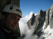
While we waited for the deep snow to clear of the mountain, Tim Pete and I made the most of a nice weather day and climbed a new route on an astounding basalt tower perched on a hill to the east of base camp. With an approach that was becoming familiar on this expedition, we left the puesto at 10:30am and arrived at the base of the tower after about 3 hours of constant uphill hiking on scree and snow, finding some guanaco footprints high on the hillside. No idea what a guanaco was doing up so high on a mountain devoid of vegetation. Upon inspection of the rock and finding it prone to breaking off in chunks, we decided to climb a new line on the unclimbed west face which offered some protection for the belayers in the form of little overhanging pods. Leading was precarious and time consuming. Every hold needed to be tested to check it was solid before trusting it. 3 long pitches got us to the top of the tower and 2 rappels later down the snow filled south gully and we were back at our packs. We decided to descend a different valley and ended up in a steep canyon, unsure whether it would cliff out or provide a way out. eventually we made it back to the base camp hut around dark.

A few days later with the huge mushroom cloud still enveloping the mountain, we headed up to climb a new route Pete had spotted on a big granite buttress high above the glacier.  Pete, Tim and I led a pitch each on perfect featured granite to the top of the buttress with 3 condors circling overhead, sometimes no more than 20 metres away. These majestic birds with massive wingspans just seem to soar in the winds of the Andes with seemingly little effort. Tim was the smallest of the 3 of us so we figured he would be the one carried away if they were to attack. Pete and I were quite content to watch the action. A short scramble down a scree gully led us back to our bags.

The weather and conditions on the mountain had dictated much of our activity and decisions. A huge mushroom cloud covered the mountain for most of the time and the wind seemed to blow incessantly. With some previous Patagonian experience, I had expected this to be the case but San Lorenzo seemed even more intense than other Patagonian peaks I had tried.

The weather for the last week of the trip didn't look promising with high winds and precipitation but it would be our last chance for an attempt on the pilar sur, so after a morning of rain we packed and headed up the glacier with the aim of reaching the advance camp before nightfall. The snow had all melted off the glacier which made the going easier than the previous trip. About half way up the glacier on the blue ice, Pete managed to step into a deep glacial pool of freezing water while gazing at the huge east face of San Lorenzo. I was just behind him at the time and wondered why he hadn't seen the pool . He lunged forward and managed to scramble out thoroughly wet and rather pissed off.  After the blue ice, we had to negotiate some horrible moraine for a few hours to reach the advance camp. About 8 hours, we reached the advance camp and began digging a hole and building a snow wall for the tent to protect against the ferocious winds.

The approaches in Patagonia always seem to test one's resolve, whether it be cold river crossings, marshy wetlands, rubble covered glaciers, deep snow or horrible loose moraine with loose boulders toppling under one's weight. Combined with a heavy pack, these approaches always seemed to weary the body, knees and feet. Its all part of the experience and most of us had some sort of niggling injury of another. We usually just taped up the offending sore appendage and popped some ibuprofen and kept going. We were all in the same boat.

The rain started about 11pm and continued for the next 30 hours unabated. I was sharing the tent with Tim and Pete, while Donie and Ronan were in the other tent. The bad weather provided a rest day that was almost welcome after the previous exhaustive day. We became quite good at killing time on this trip by reading, and playing chess and sleeping.

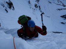
The next day dawned clear and bright. It was on. We packed and headed up for an attempt of the couloir  on the pilar sur. We didn't really know exactly where we were going but we tried to find the line of least resistance to surmount a ridge and access the big ice couloir on the pillar. The fresh snow was getting softer and wetter and in danger of avalanching as the sun hit it. Our crampons bit into the hard neve underneath in a hurry to get onto the steeper less avalanche-prone rock buttress above. A few hours after we had climbed the initial snow slopes, they completely avalanched  and left the hard snow and rock beneath completely scoured and devoid of snow.

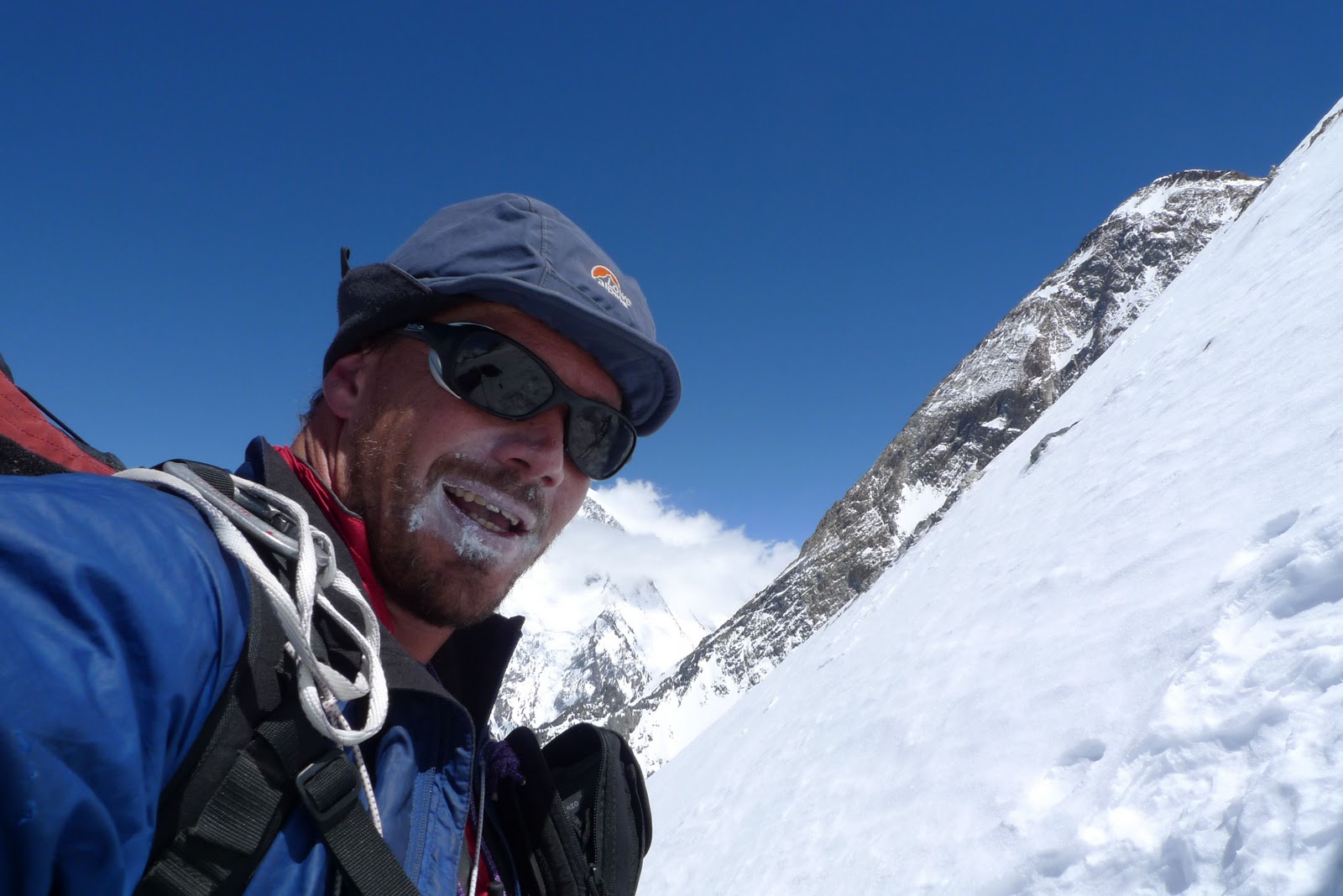
After 4 pitches of mixed climbing up snow and rock, we reached the crest and committed to an abseil down the other side of the ridge and into Chile. The climbing was time consuming and the afternoon was getting on, but the couloir beckoned so up we headed. The rock on the upper section of the pillar was completely coated in rimed ice and a few centimetres of verglas. It looked unclimbable  and incredibly hard but we headed up anyway, Simul-climbing and pitching our way up the couloir using ice screws in the blue ice to protect our passage.

The higher we climbed and the later it became, the colder it became. Wind and blown snow  seared our faces and nipped at our fingers. Upward we climbed until we had a good view of the upper pillar. It was obvious that we weren' t going to the top that day and spending the night out without a stove and sleeping bags wasn't an option. I was wearing every piece of clothing I had with me and I was still on the point of shivering. We decided to descend with still a few hours of daylight remaining at  around 8pm. Timmy led the way, drilling v-threads in the ice as rap anchors. I went 2nd to test the anchors and Pete came last after removing the backup ice screw.

As we descended, we passed Donie and Ronan who climbed on past us. Ronan was powering on like a machine, the fire in his eyes and looking strong. An image that will stay etched in my memory. A few hours later we saw their headlamps slowly descending the couloir behind us.

We reached the bottom of the couloir just before dark to find our water bottles had frozen solid allowing us only a trickle of fluid. We continued the descent in the dark, trying to find a way back over the ridge back to the advance camp in the cirque. After 5 abseils down a steep gully and a descent across the avalanche scoured slopes, we made it back to the tent at about 4am in the morning. We had been on the go for about 20 hours and slept the sleep of the dead.

Donie and Ronan arrived back at their tent about 10am after a long descent. Ronan had seriously frozen his fingers rigging the abseils down the couloir so they had to go the long way around to get back to the tent. He said fingers were bad, but the reality of how bad probably hadn't sunk in because of the tiredness of the last 24 hours efforts.

By morning, the mountain was shrouded in cloud and strong winds were battering the mountain. I packed up and began the long walk out back to base camp around midday, arriving around 9pm. The camp site was relatively sheltered but as soon as I hit the glacier, the wind battered me and threw me around, threatening to push me into the clear blue glacial pools that covered the glacier. Pete and Tim followed shortly after and decided to climb a nearby peak the next day called Cerro Penitentes.

Donie and Ronan arrived back around midnight the following day after a 12- walkout from advance camp. Ronan showed me his frosbitten fingers and I was shocked at how bad they were. There wasnt mch we could do except keep them clean and dressed and to prevent the blisters bursting and the risk of infection. It would be 4 more days till we got to a hospital for any advice and treatment.

A few days later, after carrying a few loads of gear out and eating the lst of our food, we met Gustavo at the pick up point and began the 7 hour drive back to civilisation. Ruta 40 was littered with a few 4x4 trucks on their roofs and one with a broken axle, testimony to the savage nature of the roads in this area of Patagonia. At one point, I was jolted awake (as usual I was sleeping in the car) by the van fishtailing on the loose gravel. We all braced for a potential roll over but thankfully Gustavo was experienced on these roads and kept the power on to pull us out of the fishtail. Could have been nasty.

I accompanied Ronan to the hospital where we had his finger redressed and checked by a doctor. Only time would tell how well they healed up. Not many doctors in the world have experience treating frostbite so good advice is sometimes scarce.


Over the next few days, Donie and Ronan caught their flights home and Pete Tim and I did some fantastic climbing and bouldering around El Calafate......And ate lots of BBQd meat, courtesy of my amazing Argentine friends Paula and Manza.

With an extra week to kill and the weather not looking favorable, I decided to head down to Chile to the Torres del Paine for a few days of trekking and taking photos. Somehow I managed to forget my sleeping bag and spent 4 cold nights sleeping with all my clothes on and my feet in my pack. All good training for future missions. In 5 days, the weather dished out glorious sunshine, 70km/h winds and driving rain, delivering astounding beautiful views of the surrounding mountains and rivers in the national park.
The last few days of the trip were spent idly packing, climbing with the locals and fantastic asados (BBQ) every night. A visit to the Perito Moreno glacier where Paul and Manza worked provided a welcome outing and some great photo opportunities. With the business end of the trip done, these downtimes can be some more relaxing parts of a trip and an ideal time to wind down and reflect on a great trip. The mountains and the landscape were simply incredible.  The 5 of us made for a dynamic team of good friends, great humour and great climbing partnerships and some truly memorable adventures... Thats what its all about. ..